Time zone: Europe/Rome [ ora legale ]


Apri un nuovo argomento Rispondi all’argomento  [ 2 messaggi ] 
Autore Messaggio

Rettiloide
Rettiloide

Avatar utente

Attenta AstrofilaAttenta Astrofila

Non connesso


Messaggi: 3962
Iscritto il: 06/12/2008, 12:42
Località:
 Oggetto del messaggio: Le dune anomale di Titano
MessaggioInviato: 06/08/2010, 10:45 
Immagine

Un recente studio sembra finalmente risolvere il
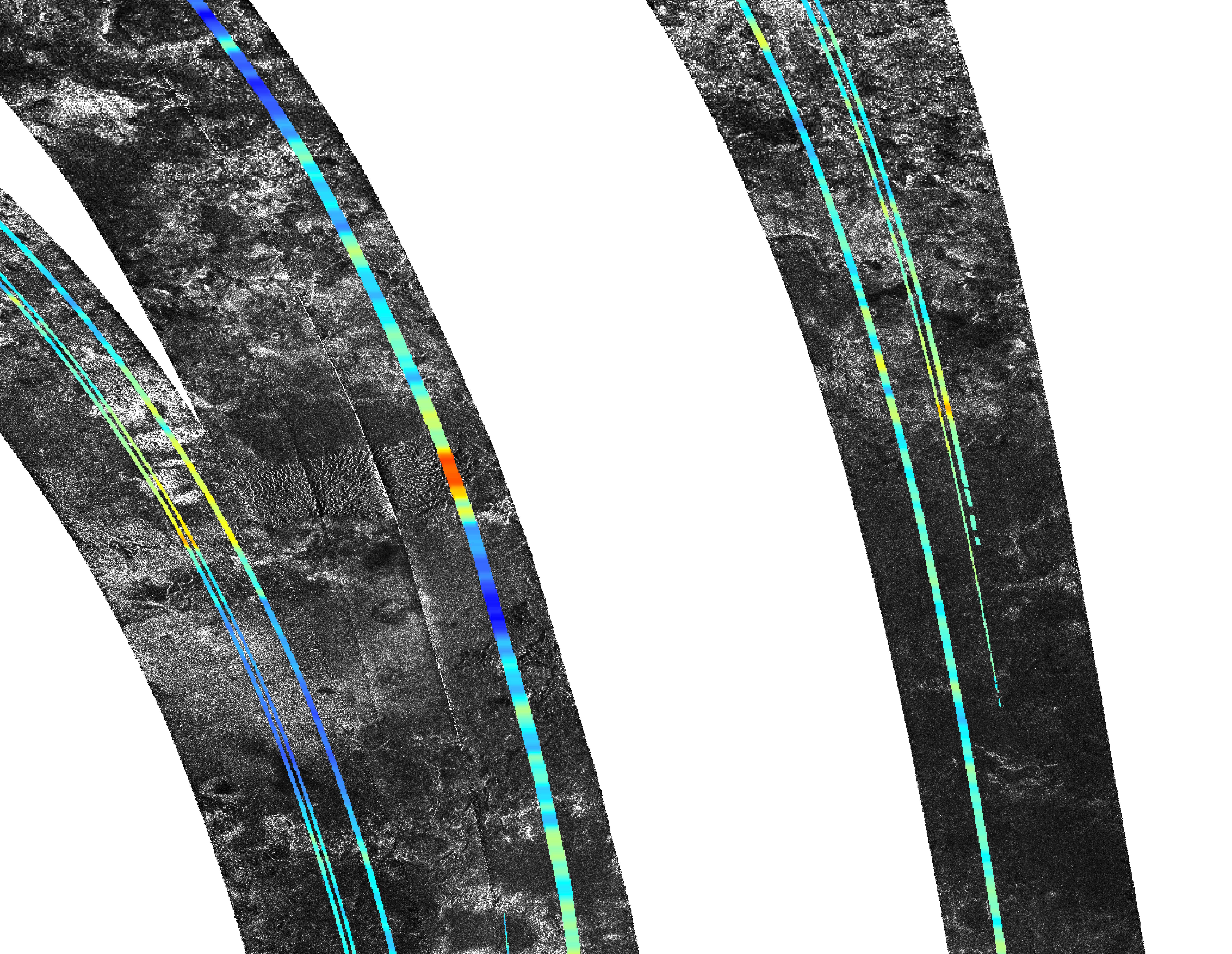
mistero delle dune sabbiose su Titano, la grande luna di Saturno, orientate in senso opposto al modello metereologico dei venti.


Enormi dune di minuscole particelle di carbone coprono più del 20% della superficie di Titano. Una fascia particolare di queste dune, entro circa 30 gradi di latitudine dell'equatore, fanno da tempo discutere gli scienziati. Il loro verso suggerisce che si siano formate da venti da ovest verso est, ma i modelli climatici predicono che il vento dovrebbe soffiare quasi sempre nella direzione opposta. Foto in alto: Mappa globale dei venti su Titano, realizzata dai dati quadriennali raccolti dalla sonda Cassini. Crediti: JPL/NASA.

Un nuovo modello di Tetsuya Tokano presso l'Institut für Geophysik und Meteorologie in Germania potrebbe contribuire a risolvere il mistero. La ricerca è stata pubblicata sulla rivista Eolie Research.

Secondo il modello, i venti in quella regione in genere puntano verso ovest, ad eccezione di due volte all'anno, intorno a ogni equinozio, quando forti raffiche giungono verso est. Anche se questi venti di Titano sono molto meno frequenti, sembrano dominare la formazione di dune di sabbia sotto di loro.

"Ci vuole una soglia minima per la velocità del vento affinchè riesca a smiovere la sabbia, così, anche se i venti soffiano più frequentemente verso ovest, la sabbia risponderà solo ai venti più forti, quindi l'orientamento delle dune rifletterà quello dei più rari ma più veloci diretti verso Est", ha scritto Ralph Lorenz fisico della John Hopkins University in un articolo pubblicato sulla rivista Science.

Immagine
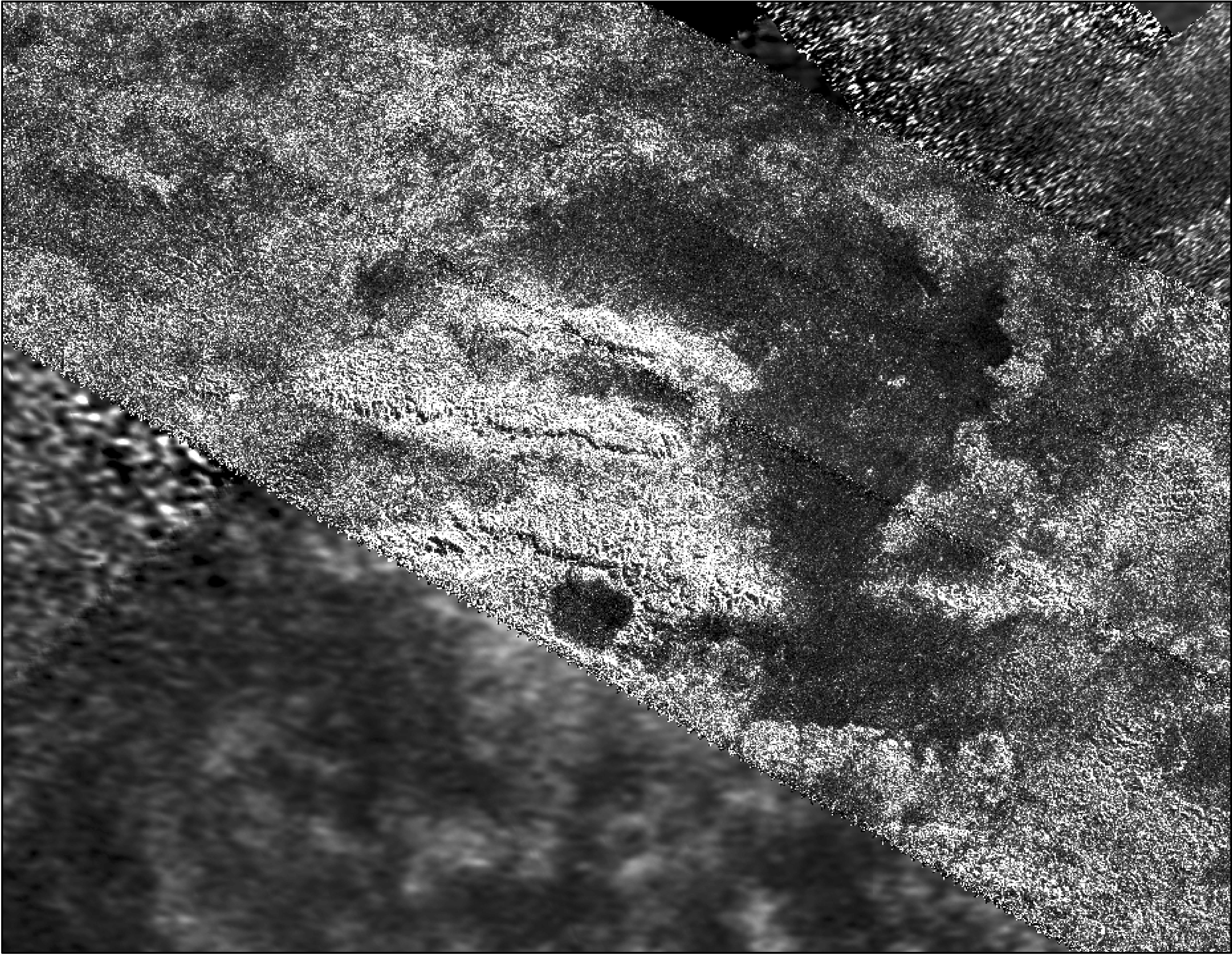
Le dune di Titano, foto in alto, a confronto con dune desertiche terrestri. Credit NASA

Le dune con lo strano orientamento su Titano sono state osservate la prima volta dalla sonda Cassini della NASA nel 2005 e fu una sorpresa per i ricercatori che si aspettavano il contrario sulla base delle direzioni note dei venti nell'alta atmosfera.
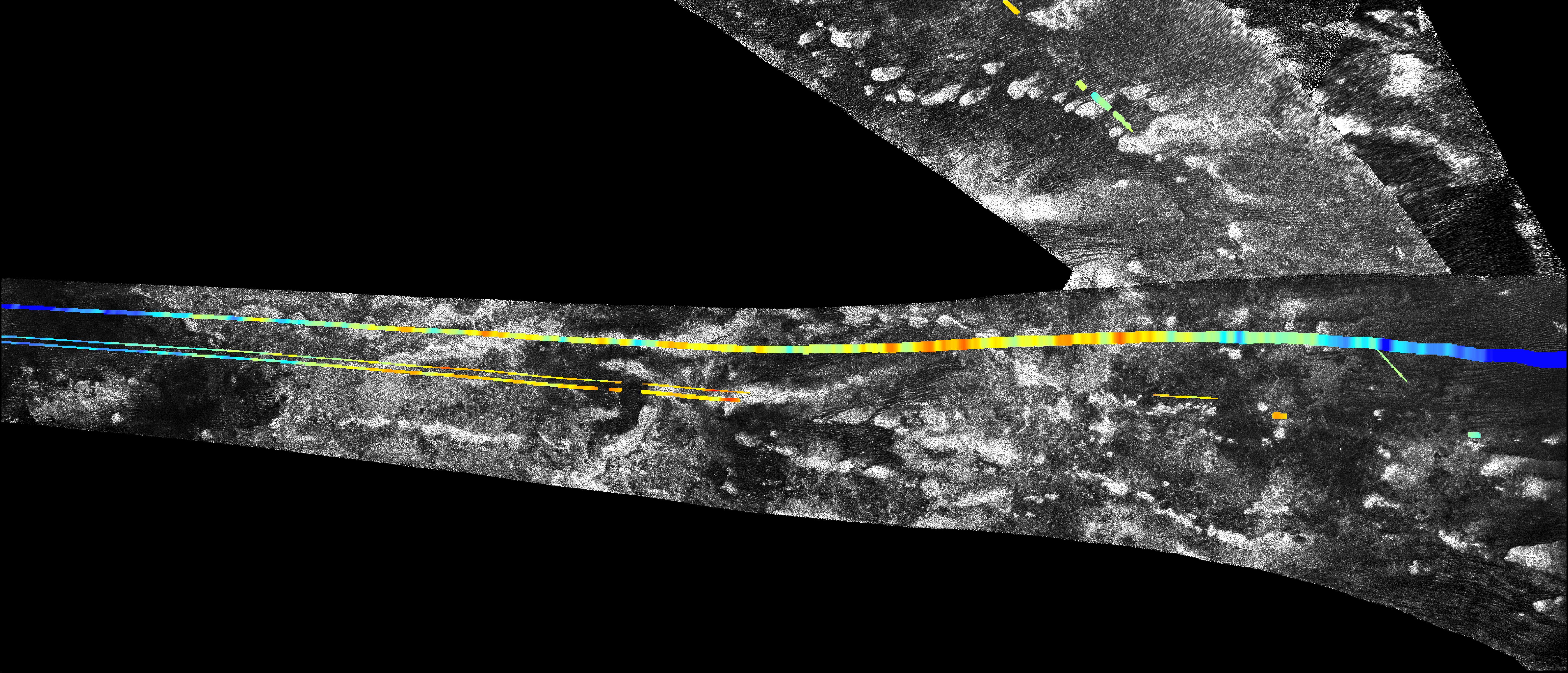
Le dune che attraversano i vasti mari di sabbia su Titano sono larghe circa un chilometro e lunghe da decine a centinaia di chilometri. Alcune creste possono essere oltre 100 metri di altezza. Le sabbie che costituiscono le dune sembrano essere composte di materiale organico e particelle di idrocarburi.

I principi di base della fisica planetaria sostengono che i venti di qualsiasi pianeta o luna dovrebbero riflettere un equilibrio a livello globale, oppure provocare un cambiamento di rotazione, secondo Lorenz.

"Se ci fossero ovunque solo venti verso est, sarebbe come accelerare la rotazione di Titano infinitamente e rallentare il vento, ma questo non è il caso" ha detto Tokano.

Il modello dei venti di Tokano risolvere questo apparente squilibrio legando il vento opposto a periodi che sono molto brevi durante gli equinozi di primavera e autunno.

Anche se si verificano solo ogni 14,5 anni terrestri (un anno Titano dura infatti 29,5 anni), le inversioni di stagione sono così forti che i loro venti esercitano un influsso dominante sulla forma delle dune di sabbia.

"Le dune sembrano registrare l'esplosione dei (WE trend) venti durante equinozio. Anche se il vento è di solito EW, i consueti venti non bastano, a quanto pare, per spostare di molto la sabbia" secondo Lorenz.

Gli scienziati attribuiscono il miscuglio turbolento dei venti all'energia solare, che irradia eccessivamente la superficie quando il Sole lambisce Titano nel corso di ogni equinozio.


Adattamento a cura di Arthur McPaul

Fonte: http://nemsisprojectresearch.blogspot.c ... omale.html - http://www.sciencedaily.com/releases/20 ... 205552.htm


Top
 Profilo  
 

Rettiloide
Rettiloide

Avatar utente

Attenta AstrofilaAttenta Astrofila

Non connesso


Messaggi: 3962
Iscritto il: 06/12/2008, 12:42
Località:
 Oggetto del messaggio:
MessaggioInviato: 14/08/2010, 09:32 
Immagine

This mosaic, made from radar images obtained by NASA's Cassini spacecraft, shows mountainous terrain on Saturn's moon Titan in the moon's northern hemisphere, north of the Aaru region. The annotated version shows topographic profiles measured by the radar instrument, with red-orange areas showing the highest elevation (in this image, 600 meters, or 2,000 feet, above the mean radius of Titan) and purple showing the lowest (in this image, 800 meters, or 2,600 feet, below the mean radius of Titan). That version also shows a grid for latitude and longitude. This region presents a mountain block near 52 degrees north latitude and 13 degrees east longitude.

The tallest features in this image are about 1,400 meters higher than the valley next to it.

Cassini's radar instrument obtained the black and white images making up the mosaic on July 22, Sept. 22, and Oct. 9, 2006. In radar images, objects appear bright when they are tilted toward the spacecraft or have rough surfaces. The topographical data were derived from the same flybys.

Source: http://photojournal.jpl.nasa.gov/catalog/PIA13330

Immagine

This mosaic, made from radar images obtained by NASA's Cassini spacecraft, shows parallel mountain chains on Saturn's moon Titan. The mountains appear along the northwest border of a region known as Xanadu, two degrees south latitude and minus 127 degrees west longitude. The annotated version shows a grid for latitude and longitude.

The tallest features in this image, which were mapped by the radar instrument, are about 1,900 meters taller than the surrounding plains. Scientists believe the structures rose up because the lithosphere, the outermost layer of the surface, folded up during deformation of the outer water ice shell.

Cassini's radar instrument obtained the images on Feb. 15, 2005 and May 12, 2008. In radar images, objects appear bright when they are tilted toward the spacecraft or have rough surfaces.

Source: http://photojournal.jpl.nasa.gov/catalog/PIA13331

Immagine

This mosaic, made from radar images obtained by NASA's Cassini spacecraft, shows parallel mountain chains on Saturn's moon Titan, near an equatorial region known as Adiri. This mosaic focuses on an area around 10 degrees south latitude and 145 degrees east longitude. The annotated version shows topographic profiles obtained by the radar instrument, with red areas showing the highest elevation (in this image, 250 meters above the mean radius of Titan) and purple showing the lowest (in this image, 450 meters below the mean radius of Titan). That version also shows a grid for latitude and longitude.

Scientists believe the structures rose up because the lithosphere, the outermost layer of the surface, folded up during deformation of the outer water ice shell.

Cassini's radar instrument obtained the black-and-white image of the terrain on Feb. 22, and Oct. 28, 2005. In radar images, objects appear bright when they are tilted toward the spacecraft or have rough surfaces. The topographical data were derived from the same flybys.

Source: http://photojournal.jpl.nasa.gov/catalog/PIA13332


Top
 Profilo  
 
Visualizza ultimi messaggi:  Ordina per  
Apri un nuovo argomento Rispondi all’argomento  [ 2 messaggi ] 

Time zone: Europe/Rome [ ora legale ]


Non puoi aprire nuovi argomenti
Non puoi rispondere negli argomenti
Non puoi modificare i tuoi messaggi
Non puoi cancellare i tuoi messaggi
Non puoi inviare allegati

Cerca per:
Vai a:  
cron
Oggi è 02/05/2025, 22:08
© 2015 UfoPlanet di Ufoforum.it, © RMcGirr83.org